November 24, 2023 – Semih YENİGÜL & Serdar BAYBURT

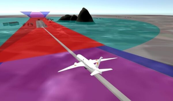
Exploring distant lands and traveling to far-off destinations doesn’t seem as difficult as it used to, does it? Thanks to modern transportation, it is now possible to experience an adventure in the high skies for hours. So, what is the power that allows us to travel at these heights? It is undoubtedly the safest and most reliable mode of transportation, air travel. But have you ever wondered about the invisible heroes behind a safe flight? Those invisible shapes in the sky that are created to ensure that planes encounter no obstacles, safeguarding us… Let’s take a closer look at the world of these mysterious protectors, which ensure the safe flight of airplanes and protect them from obstacles in the flight path and consider what might have been overlooked when identifying them.

In this article, we focus on one of the most critical issues in the aviation sector, which affects flight safety: the crucial process of determining the invisible surfaces that protect airplanes and us in the sky. These surfaces are applied by the relevant authorities in accordance with Annex 14 and Document 9137 – Part 6 published by ICAO, which determines the international civil aviation standards. However, these standards contain some gaps, which also bring certain risks. In this article, which deals with the issue of “Aerodrome Elevation Datum for Inner Horizontal Surface”, we will examine in detail the complexities of the reference height used in the determination of the inner horizontal surfaces of airports and the challenges encountered in the stage of determining this reference elevation by the relevant authorities.
Elevation Datum, or aerodrome elevation reference, is an important reference point used to measure the heights of airports in international aviation. It also serves as the basic reference point used in the determination and design of the inner horizontal surface of airports and plays a vital role in air traffic management and flight safety. This reference point aims to create consistency and compatibility for the international aviation community by establishing a standard in airport design and operations. The Inner Horizontal Surface, on the other hand, plays a critical role in airport design and planning; as it is used to ensure the safe use of runways, to ensure the protection of aircraft from obstacles during take-off and landing, and to secure the general airport safety.
The height of the inner horizontal surface is a value determined by varying radii depending on the airport code. However, the height of this surface must be 45 meters above the reference height (Elevation Datum) established at the airport. Details on this are not included in Annex 14, and it is recommended to refer to Document 9137: ASM, Part 6 for this information. In Section 6 of Doc 9137, it is seen that the selection of elevation datum is important for the inner horizontal surface. If the elevation difference between the runway thresholds is less than 6 meters, it is stated that the situation is not very critical. However, if the elevation difference is more than 6 meters, a number of important issues need to be considered. As it is understood, if the difference between the two runway thresholds is less than 6 meters, it does not matter which threshold height you choose. However, if this difference is large, it is necessary to consider a number of factors. This has led to different applications at various airports; different approaches such as drawing based on the lowest threshold, drawing based on the highest threshold, and/or using the average of the two thresholds are seen.
The ICAO’s Annex 14 and Doc 9137 Part 6 documents reveal that the authorities are given wide discretion on the elevation datum, considering the national and regional requirements of each country. Civil aviation authorities have used this flexibility with local standards and instructions documents that show a tendency to prefer different values on this issue. However, the lack of a clear standard for determining this height and the selection of different heights by each authority on its own initiative has led to the change in the height of the inner horizontal surface and other related surfaces created, and this situation has caused the environmental safety priorities to differ, becoming a critical issue for aviation.
So, what could be the tangible consequences of using different airport elevation references when creating these safety surfaces? The safe execution of an aircraft’s landing and take-off procedures, especially in the first take-off and final approach, is closely related to the surrounding obstacles. These imaginary surfaces, unseen but essential for ensuring flight safety, limit the heights of surrounding structures. However, the selection of airport elevation becomes crucial in this context. Vertical construction is not possible at very high elevations. Therefore, if these surfaces are created based on the threshold with lower elevation datum, a mania may create a violation by jeopardizing flight safety for the inner horizontal surface. On the other hand, if the elevation datum is selected from the threshold with a higher elevation, the same obstacle may not pose a violation if it remains below the height of the inner horizontal or conical surface. Do you think it is appropriate for this obstacle to no longer be considered a threat based on these surface heights? Unfortunately, the answer is no. Changing parameters to elevate a surface further may place previously identified risks below the limit, but it does not eliminate the danger posed by the obstacle in terms of flight safety. This is especially crucial if the obstacles are in close proximity to the approach and departure corridor.

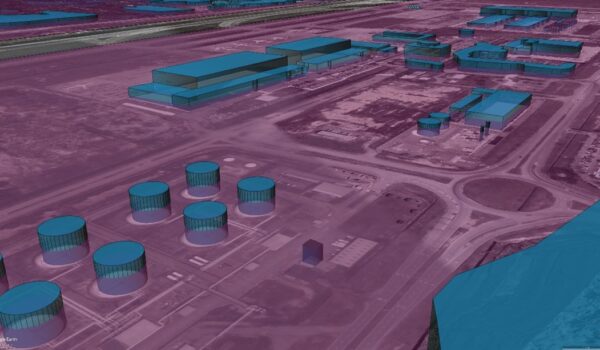
Let’s consider a specific example in the Asia-Pacific region, focusing on an international airport in a country with a height difference of 12.3 meters between two runway thresholds. When low, medium, and high threshold elevations are individually selected as the elevation datum, it is observed that an approximately 2 km2 terrain obstacle area exits the category of risky areas. Similarly, according to the results of analyses determined based on the lowest and highest values, a total of 24 critical obstacles, including transmission lines, building blocks, and towers, have been identified as being free from risk. Furthermore, it should be noted that approximately 500 individual or grouped trees are also excluded from the obstacle category. In this case, it is essential not to forget that conducting flight and other operational procedures by overlooking these critical elements could be problematic. So, how safe is it for these obstacles not to be considered critical based on these surface heights?
What can be done to correct or improve this situation? New flight procedures suitable for the new surface heights can be designed. Perhaps engineering analyses can assess whether the emergence of new obstacles will affect flight safety. However, these steps are actions that should always be taken for flight safety. The crucial point here is the elevation datum chosen when producing the inner horizontal surface in the initial stages. Selecting parameters not aligned with standards and based on initiatives is not always an effective approach. Constructions around the airport are restricted by specific plans and local regulations. Local regulations and construction rules on the Obstacle Limitation Surface (OLS) may vary. The obstacle plan (OLS) is part of the urban planning approach, and these surfaces are created in accordance with ICAO standards that comply with local regulations and statutes. The key point is to establish the elevation datum in a standardized manner when creating these surfaces. ICAO determining this parameter with a clear design standard will ensure its more secure and consistent implementation. Rules being tied to standards instead of initiatives would be beneficial for everyone.
Aviation regulations seem as if each word has been written through lived experiences. They narrate that every flight, every landing, and every takeoff take place in an arena filled with potential dangers. These rules are a reflection of lessons learned from past experiences. All these rules become even more stringent with each error, failure, and tragedy encountered. Aviation requires discipline, precision, and adherence to standards, and these rules are written to establish discipline and ensure the safety of each flight. In other words, “aviation rules are written through lived experiences,” expressing the seriousness of this field and the potentially serious consequences of not complying with the rules. In this context, the selection of the correct airport elevation plays a critical role in airport and flight safety. We believe that making these choices requires meticulous planning to provide a safe framework for flight operations.


